349
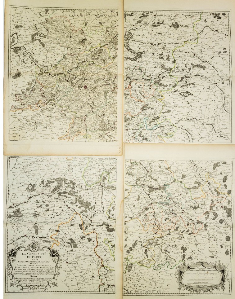
Large map with four sheets. JAILLOT. La Généralite de Paris, divisé en ses 22 Élections.
EUR 300,00
Base d'asta
EUR 400,00 / 500,00
Stima
Descrizione
Large map with four sheets. JAILLOT. La Généralite de Paris, divisé en ses 22 Élections.
JAILLOT, Bernard-Antoine. La Généralite de Paris, divisé en ses 22 Élections savoir Paris, Beauvais, Compiègne, Senlis, Meaux, Rozoy, Coulommiers, Montereau, Provins, Nogent, Sens, Joigny, S. Florentin, Tonnerre, Nemours, Melun, Étampes, Mantes, Montfort-l’Amaury, Dreux, Pontoise, Vézelay, dédié à Messire Nicolas Prosper Bauyn, Chevalier, Seigneur d’Angervilliers, Conseiller d’État, Intendant de la Généralité de Paris, par Bernard Jaillot, Géographe du Roy. Gravè par Delahaye.
Paris, chez l’Auteur, 1725
Carta geografica di grandi dimensioni (150 x 110 cm) composta da 4 tavole di 650x515 mm. ciascuna. Contorni in coloritura coeva. Due cartigli decorativi con titolo e scala in miglia italiane. Leggero alone d’umidità al margine esterno di due fogli. Per il resto buono stato di conservazione.
Rara carta geografica composta da 4 fogli a creare una grande mappa unitaria che raffigura un vasto territorio conosciuto come “la Généralité de Paris”, il più grande dei distretti amministrativi sotto l’Ancien Regime, che coprivano Parigi e la regione circostante. Comprendeva città come Compiègne e Beauvais a nord e si estendeva a sud fino alla regione del Nivernais.
Bernard Jaillot fu un cartografo francese attivo nella prima metà del XVIII secolo. Figlio di Bernard Jean Hyacinte Jaillot e nipote di Alexis Hubert Jaillot, fece parte della prestigiosa famiglia di cartografi dei Jaillot.
Condition Report
Large map (150 x 110 cm) consisting of 4 plates of 650 x 515 mm. each. Outlines in contemporary colouring. Two decorative cartouches with title and scale in Italian miles. Slight sign of humidity on the margin of two sheets. Otherwise good condition.
Rare map consisting of 4 sheets creating a large unitary map depicting a vast territory known as ‘la Généralité de Paris’, the largest of the administrative districts under the Ancien Regime, which covered Paris and the surrounding region. It included cities such as Compiègne and Beauvais in the north and extended south to the Nivernais region.
Bernard Jaillot was a French cartographer active in the first half of the 18th century. Son of Bernard Jean Hyacinte Jaillot and grandson of Alexis Hubert Jaillot, he was part of the prestigious Jaillot family of cartographers.
mar 11 Febbraio 2025
Orari Asta
Via dei Soncin, 28
35122 Padova
ESIBIZIONE: 6-8 Febbraio 2024 solo su appuntamento.
ESIBIZIONE: 6-8 Febbraio 2024 solo su appuntamento.

