Share our site:

SHARE
284
LA CONDAMINE. Journal du voyage fait par ordre du roi, à l'Équateur.
1751
EUR 1.200,00
Base d'asta
EUR 2.000,00 / 2.500,00
Stima
Descrizione
LA CONDAMINE. Journal du voyage fait par ordre du roi, à l'Équateur.
1751
1751
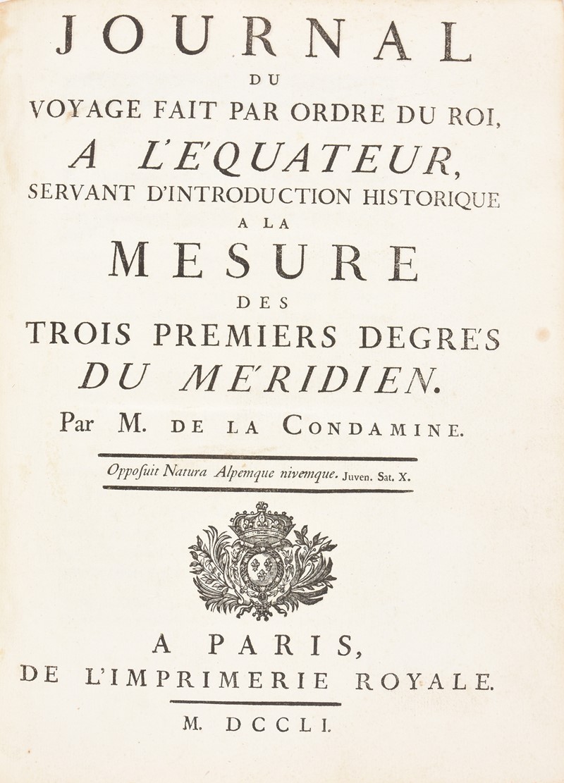
LA CONDAMINE, Charles-Marie; de. Journal du voyage fait par ordre du roi, à l'Équateur, servant d'introduction historique à la mesure des trois premiers degrés du Méridien.
Paris, Imprimerie Royale, 1751
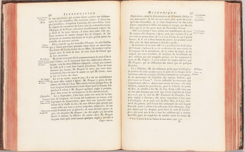
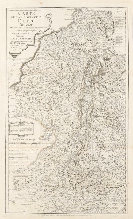
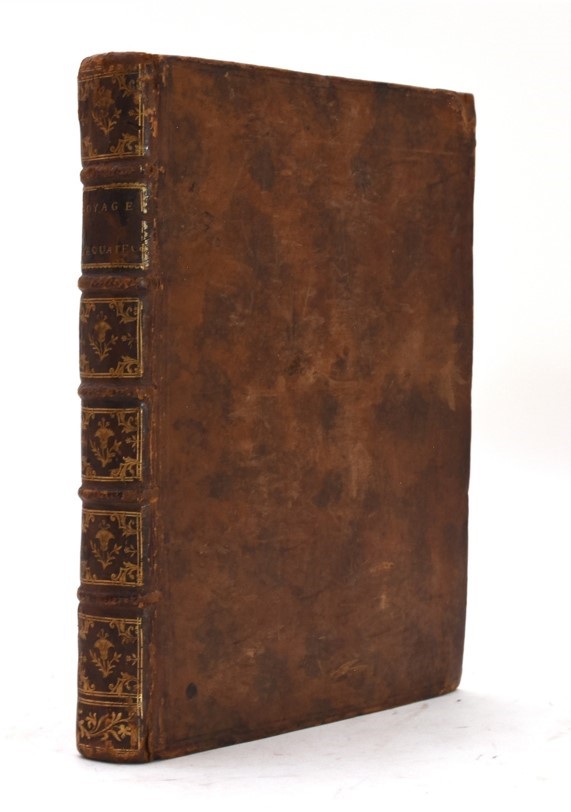
4to. 247x185 mm. Legatura coeva in vitello marmorizzato, fregi in oro sul dorso a nervi, tagli rossi. Pagine [2], xxxvi, 280, xv. Un foglio a stampa ripiegato fuori testo. 5 Tavole incise in rame fuori testo, numerate I-V, quattro delle quali ripiegate. Una grande carta geografica più volte ripiegata in fine. In totale 6 tavole incise in rame fuori testo. Tracce duso alla legatura, sporadico foxing, qualche pagina e la Tavola II con lievi bruniture, minuscola traccia di umidità allangolo basso di p. 277, bellesemplare.
Prima edizione di quest'opera dell'esploratore, geografo e matematico francese La Condamine (1701-1774), basata sulle sue esperienze in Sud America. Fu uno degli "Académiciens du Pérou" scelti dallAcadémie des Sciences per recarsi in Perù allo scopo di misurare diversi gradi del meridiano all'equatore. Confrontando i loro risultati con quelli ottenuti da una missione simile in Lapponia, l'Académie sperava di risolvere la controversia tra newtoniani e cartesiani sul fatto che la terra fosse appiattita o allungata ai poli. La spedizione del Perù si imbarcò per il Sud America nel 1735, raggiungendo Quito nel giugno dell'anno successivo. Le loro misurazioni geodetiche, completate nel 1743, convalidarono l'ipotesi di Newton. Illustrato con 6 tavole fuori testo con la mappa dell'itinerario di La Condamine e la pianta di Quito; la grande carta ripiegata con il territorio di Quito è di M. dAnville. Opera completa con il foglio ripiegato, a pagina 163, che riporta le osservazioni di La Condamine e due dei suoi compagni, Louis Godin e Pierre Bouguer.
Sabin 38479; Borba de Moraes I:380-381; Norman 1250.
Condition Report
4to. 247x185 mm. Contemporary binding in marbled calfskin, gilt ornaments on the spine with raised bands, red edges. Pages [2], xxxvi, 280, xv. A folded sheet outside the text. 5 engraved copper plates outside the text, numbered I-V, four of which folded. A large map folded several times at the end. In total 6 copper plates engraved outside the text. Traces of wear on the binding, sporadic foxing, a few pages and Plate II with slight browning, a tiny trace of humidity in the lower corner of p. 277, a nice copy.
First edition of this work by the French explorer, geographer and mathematician La Condamine (1701-1774), based on his experiences in South America. He was one of the "Académiciens du Pérou" chosen by the "Académie des Sciences" to journey to Peru for the purpose of measuring several degrees of the meridian at the Equator. By comparing their results with those obtained by a similar mission to Lapland, the Académie hoped to settle the controversy between the Newtonians and Cartesians over whether the earth was flattened or elongated at the poles. The Peru expedition embarked for South America in 1735, reaching Quito in June of the following year. Their geodetic measurements, completed in 1743, validated Newton's hypothesis.
Illustrated with 6 plates outside the text with the map of the itinerary of La Condamine and the plan of Quito; the large folded map with the territory of Quito is by M. d'Anville. Complete work with the folded leaf, on page 163, which reports the observations of La Condamine and two of his companions, Louis Godin and Pierre Bouguer.
Ref. Sabin 38479; Borba de Moraes I:380-381; Norman 1250.
Bibliografia
Sabin 38479; Borba de Moraes I:380-381; Norman 1250.
Certificato di Avvenuta Spedizione N. 3867 del 30/10/2023
Certificato di Avvenuta Spedizione N. 3867 del 30/10/2023
mar 11 Febbraio 2025
Orari Asta
Via dei Soncin, 28
35122 Padova
ESIBIZIONE: 6-8 Febbraio 2024 solo su appuntamento.
ESIBIZIONE: 6-8 Febbraio 2024 solo su appuntamento.
Bado e Mart Auctions
https://www.badoemart.it/img-footer/logo.png
Bado e Mart Auctions sas
Via Dei Soncin, 28
35122 Padova Veneto Italy
Tel. +39 049 8755317
Fax +39 049 8755317
E-mail: info@badoemart.it
Partita IVA IT00773300280
35122 Padova Veneto Italy
Tel. +39 049 8755317
Fax +39 049 8755317
E-mail: info@badoemart.it
Partita IVA IT00773300280
Follow us on
Copyright Bado e Mart Auctions 2018. All rights reserved.
Realized by Thetis Srl
Realized by Thetis Srl